When it comes to planning and maintaining a fiber network, accuracy and clarity are essential. If your data isn’t up to date or if your team is working from multiple sources, the smallest task can turn into a time-consuming, error-prone process. But with a few smart practices and the right tools in your corner, you can simplify the complex and build a foundation for better decisions, faster deployments, and fewer headaches across the board.

Here are five best practices to improve how your team manages fiber network data—each one proven, practical, and supported by tools like CrescentLink™:
1. Conduct Regular Data Audits
Fiber networks don’t stand still; routes change, cables are added, and splices move. Over time, these changes can leave your records out of sync. That’s where routine data audits come in. Take time each quarter to review your fiber map and asset database. Look for missing details, duplicated records, or legacy files that no longer reflect reality.
Modern GIS tools like CrescentLink help here by flagging inconsistent or incomplete entries, giving you a clear path to cleaner data. Accurate data is the bedrock of smart network planning. Without it, every decision you make is based on a guess. With it, you move forward with confidence.
2. Centralize Your Fiber Data
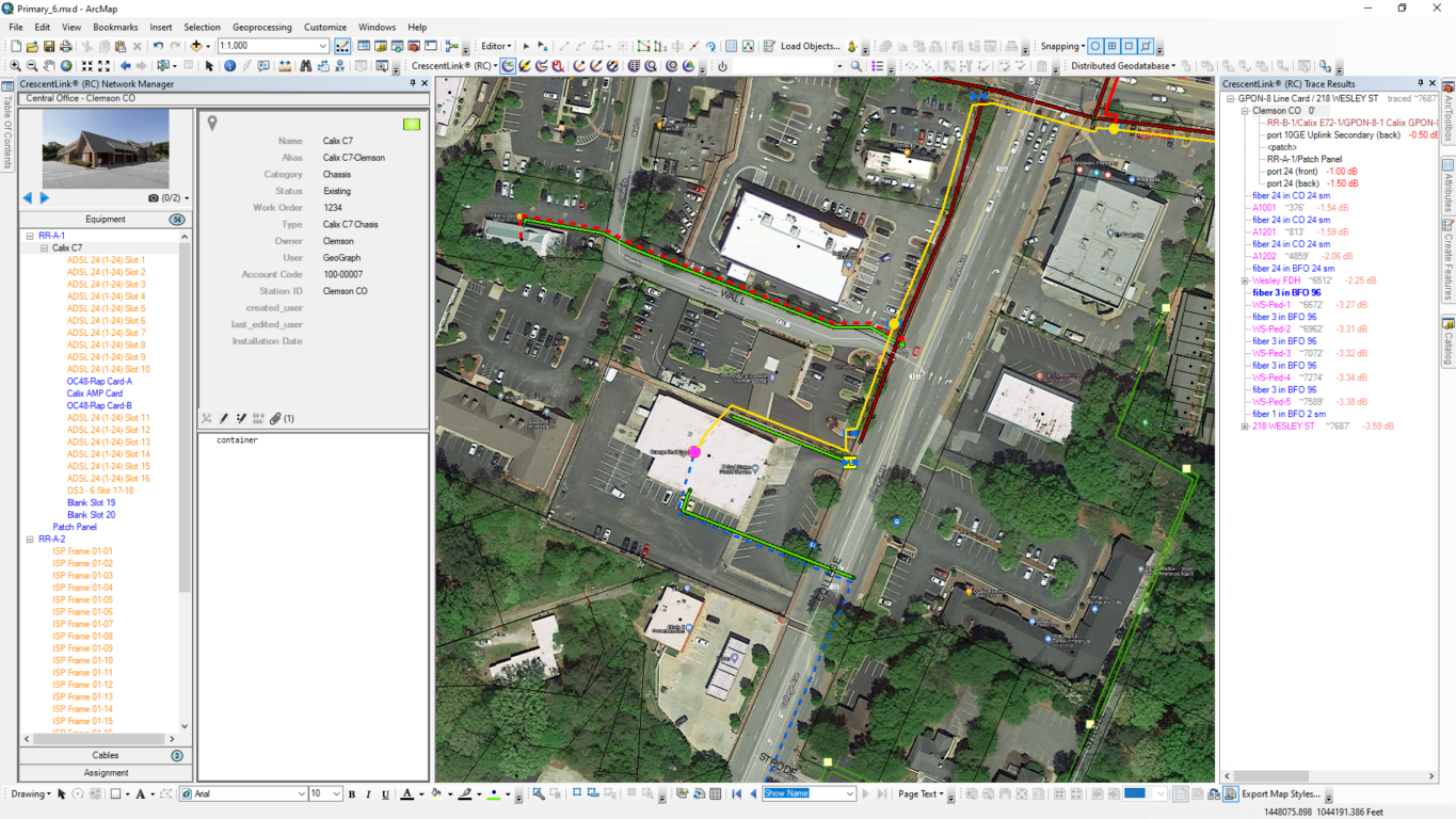
Still juggling spreadsheets, CAD files, and sticky notes across different departments? You’re not alone, but it’s time to change that. Centralizing your fiber network data in one system gives everyone, from GIS analysts to field techs, access to the same up-to-date information. That means fewer errors, faster communication, and no more wondering which version of the network map is the “real” one.
CrescentLink acts as a single source of truth for your fiber assets, tying every cable, splice, and connection point to a live, visual map. It’s easier for your team, and it eliminates the confusion that comes from working in silos.
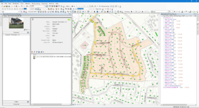
3. Use GIS to Plan Visually and Accurately
Paper maps and static diagrams can’t keep pace with today’s network demands. By integrating your fiber data into a GIS, you can visualize your infrastructure in context, seeing exactly where assets are, what surrounds them, and where expansion is possible.
CrescentLink builds telecom-specific data management directly into Esri’s ArcGIS platform, giving you the tools to model, plan, and analyze your network in one place. With visual clarity comes better decision-making and fewer surprises in the field.
4. Train and Empower Your Team
A tool is only as powerful as the people using it. Make sure your team knows how to get the most from your fiber mapping platform.
Start with strong onboarding and follow up with refresher sessions, FAQs, and easy-to-access resources. CrescentLink’s user-friendly interface makes adoption simple, even for staff who aren’t GIS pros. And when everyone understands the why behind accurate mapping, they’ll take ownership of maintaining it.
5. Automate and Stay Ahead of Issues
Fiber networks generate a lot of data. Trying to manage it all manually isn’t just inefficient—it’s risky. Automate what you can. CrescentLink’s real-time alerts instantly notify when a fiber line is cut or a splice fails. Automate routine reports and updates. Even small time-savers, like pre-set templates for new cables, add up to smoother workflows and fewer errors.
Let technology take care of the repetitive work so your team can focus on what matters most: keeping your network running strong.
Final Thoughts
Efficient fiber network planning starts with a strong fiber mapping foundation. By auditing regularly, centralizing your data, using GIS, empowering your team, and embracing automation, you’ll lay the groundwork for a more agile, resilient, and future-ready network.
And if you’re looking for a platform that supports all five steps out of the box, we’d be happy to show you what CrescentLink can do.