Frequently Asked Questions

Top Questions About GEOGRAPH
We work with a large variety of customers which essentially includes any one working with fiber, copper, or coax networks. Our largest customer base is within the electric cooperative and the broadband network provider sectors. We also work with middle mile providers, HFC networks, generation and transmission power entities, municipal governments, and corporate campuses.
Yes, we have a very popular and effective training program to help you easily and quickly get up to speed using CrescentLink to manage your fiber, copper, or coax network. We offer on-site training where our team can work with you at your location, and we also offer quarterly workshops via Zoom Webinar where a small number of attendees can learn together online. Both of these training programs are two-day sessions which are designed for both new users or those seeking a refresher.
Yes, we have an extensive library of articles and case studies in our Customer Support Portal. These are easily accessible for any GEOGRAPH customer and provide excellent information to help educate and inform. We utilize a search engine with keywords so you can easily search for information of interest.
If you are experiencing any problems working with CrescentLink, then it is recommended you complete a support ticket. You can access the Customer Support Portal from our website home page. Simply complete the form detailing your concerns or queries and we will be in touch, most often within a sub-24 hour period. Our Customer Support team has consistently earned a 100% customer satisfaction rating and resolves most issues quickly and during the call.
The onboarding process for new customers vaires and is based on a number of factors such as data accuracy, data completeness, and data format. Hardware and software usage is also an important factor to review. For most customers, the onboarding process takes a few months; however, we have also had instances where new customers were up and running the next day. It is important to note that we do our best to quickly understand your circumstance, and we work with you to create a plan together.
It is our goal to be a trusted software resource during the onboarding process, and we ensure that new clients are prepared. If you are just getting started with your network mapping, or if you need to migrate a legacy network to our software, we work with you to create a plan from the start. We discuss your goals, recommend best practices, and create a timeline for integration that meets your needs. All GEOGRAPH customer support and professional services are handled in-house by our local, U.S.-based team.
We provide quite a large variety of GIS services for clients in need of tools to manage fiber networks. In addition to our CrescentLink and FourSevens software, we offer training & support, data migration, network planning & design, remote GIS management, and GIS consulting.

Top Questions About Our Software
We have a team of GIS analysts that review your existing data and make an assessment on the best way to complete the data migration. We have successfully managed data transfers from client and competitor files, and our Professional Services team has created a comprehensive process for managing all scenarios.
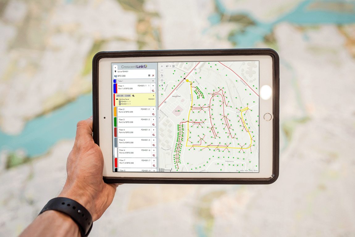
Yes. By using CrescentLink Web Experience, our web-based complement to CrescentLink Desktop, you can gain access to your network from any web-enabled device. CrescentLink Web Experience provides you with access to CrescentLink Tracing Tool where you can generate splice diagrams and perform other operations to manage your network.
One of the most popular CrescentLink features is tracing – either at the strand level of cable or at the port level of equipment. Tracing can be performed within workflows and provides you with information to help troubleshoot outages and make decisions on potential expansion, to name a few actions.
CrescentLink Desktop – and its complement, CrescentLink Web Experience – is built on Esri’s® ArcGIS® Desktop and Enterprise systems and is intended to be a scalable, all-encompassing solution to your network mapping needs. Our solutions can support organizations of all sizes, ranging from smaller shops with only one or two users to large-scale, enterprise-level organizations with many users.
CrescentLink Desktop is an extension on Esri® ArcGIS® and is compatible with versions 10.6.1 and above. Other hardware and software requirements exist for our CrescentLink Web Experience and other configurations of both the back-end database storage and the chosen method of user access to both the data and the software.


